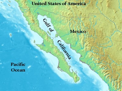
Geographic coordinates: 23.817N, 108.423W Magnitude: 6.2
Depth: 10 km
Universal Time (UTC): 8 Oct 2014 02:40:54
Time near the Epicenter: 7 Oct 2014 19:40:54
Local standard time in your area: 8 Oct 2014 02:40:54
Location with respect to nearby cities:
121 km (75 mi) WSW of El Dorado, Mexico
128 km (79 mi) SW of Navolato, Mexico
128 km (79 mi) SW of Campo Gobierno, Mexico
135 km (83 mi) SW of Costa Rica, Mexico
1077 km (667 mi) WNW of Mexico City, Mexico